
Before construction, real estate developers in Bhiwandi can use drone surveying to generate millimeter-accurate topographical maps of raw land parcels in hours, work that normally required 10 to 15 days of survey teams’ time and was prone to manual error. With high-resolution aerial imaging and orthomosaic stitching software, developers can get accurate boundary information, drainage contour analysis and investor-ready visuals before the first excavator hits the site. In the fast-paced industrial real estate corridor of Bhiwandi, this data advantage directly compresses project timelines and reduces earthwork cost overruns.
Why Traditional Surveys Don’t Work Here
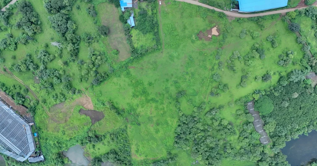
Commercial plots in Bhiwandi are not small, clean, walk-to sites. These are tough.
Hundreds of acres of grass, mud and makeshift structures
Post-monsoon? Ground teams literally can’t walk the site.
Boundary battles are common – but no one’s got proof.
Traditional survey teams do their best. But they’re slow, and their data is incomplete. By the time you find a mistake, you are well into earthwork – and the fixes are expensive.
What Drone Surveying Actually Gives You
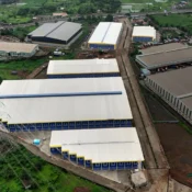
Precise top-down aerial site mapping and land survey in Bhiwandi captured by Cinematic360, demonstrating how developers use nadir drone photography for initial layout planning and pre-construction blueprints.
Top-Down Boundary Map The drone flies straight overhead and captures every inch of your plot — exact boundaries, encroachments, access roads. Clean. Legal. Court-admissible.
Orthomosaic Map Thousands of drone photos stitched together into one GPS-accurate 2D map. Your architect imports it directly into AutoCAD. No guesswork. No second visit.
Standard Drone PhotoOrthomosaic Map
Can you measure from it? ❌ No ✅ Yes — millimeter level
Works in AutoCAD? ❌ No ✅ Yes
Good for investors? ✅ Yes ✅ Even better
Legal / planning use? ❌ No ✅ Yes
How Cinematic360 Runs a Site Survey — 5 Simple Steps
Step 1 — DGCA Clearance Bhiwandi sits close to Mumbai’s metro airspace. We file all Digital Sky permissions before the drone goes up. No shortcuts.
Step 2 — Ground Markers We place GPS-marked points across the site. These lock the drone data to real-world coordinates — the thing that makes your map actually accurate.
Step 3 — The Aerial Shoot High-res sensors. 80% image overlap. Systematic grid pattern over the full site. Not just “flying around and hoping for the best.”
Step 4 — Data Processing We process everything into: Orthomosaic Map + Digital Elevation Model + Contour Lines. All in one package.
Step 5 — You Get the Files GeoTIFF, DXF, and high-res JPEGs — ready in 48 hours. Your architect, engineer, and marketing team can all start working the same day.
What This Does for Your Business
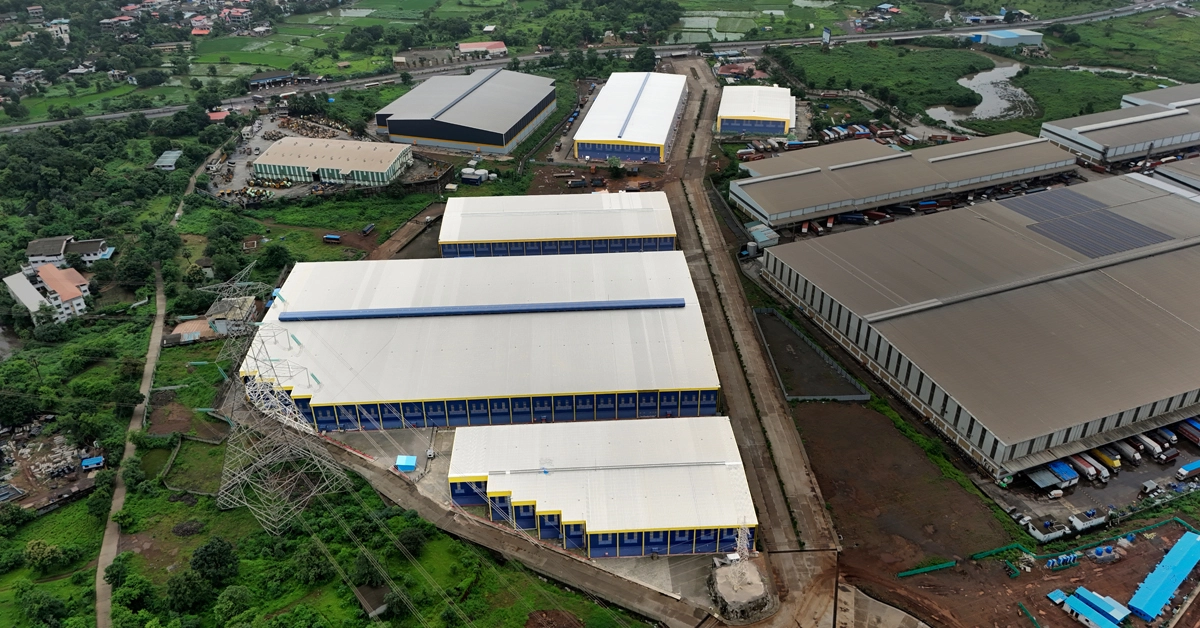
Ongoing commercial real estate site tracking and infrastructure progress mapping in Bhiwandi captured by Cinematic360, showcasing active land development alongside existing logistics hubs.
Investor Presentations That Actually Work Show your investor the raw plot on one side. Show the approved warehouse layout sitting on top of it on the other side. They don’t have to imagine anything. They see it. That’s when trust happens.
Earthwork Budget You Can Actually Trust Accurate contour data tells you upfront where cutting is needed and where filling is needed. No surprise bills mid-construction. Estimates become 25–30% more reliable.
Start Selling Before You Break Ground Developers who pitch with drone data close commercial bookings 4 to 6 months before construction starts. Because data gives confidence. And confidence closes deals.
Before You Book Any Drone Agency — Quick Checklist
- Do they have a DGCA Remote Pilot Certificate?
- Do they file Digital Sky permissions before flying?
- Do they carry drone liability insurance?
- Do they deliver a proper orthomosaic — not just photos?
- Have they worked in Bhiwandi or Mumbai before?
If any answer is no — that’s not a vendor. That’s a risk.
Let’s Map Your Site
Book a Free Site Mapping Consultation →
Need ground-level photography alongside the aerials? See our real estate photography packages →
Quick FAQs
How long does a survey take? For a 50–150 acre plot: flying takes 4–6 hours. Files are ready in 48 hours.
Can you survey during monsoon? Not in heavy rain or strong winds. Best window is October to May.
Does the map work in AutoCAD? Yes — we deliver GeoTIFF and DXF formats, both AutoCAD-ready.
Who handles the DGCA paperwork? We do. You don’t have to file anything.
Cinematic360 — Commercial Drone Operations, Mumbai. See our drone work →