
Selling the Invisible Value of Premium High-Rises
Let’s address something most developers dance around, but never say out loud.
You are not selling a flat in Mumbai’s luxury segment. You’re selling the view someone has when they walk to their window at 6:47pm on a Tuesday evening.
That’s the real McCoy. The square footage is just the vessel.
And the hard truth is that a 2D floor plan, a generic ground level photo or a brochure created in 2019 just can’t sell that feeling. Not in the same universe.
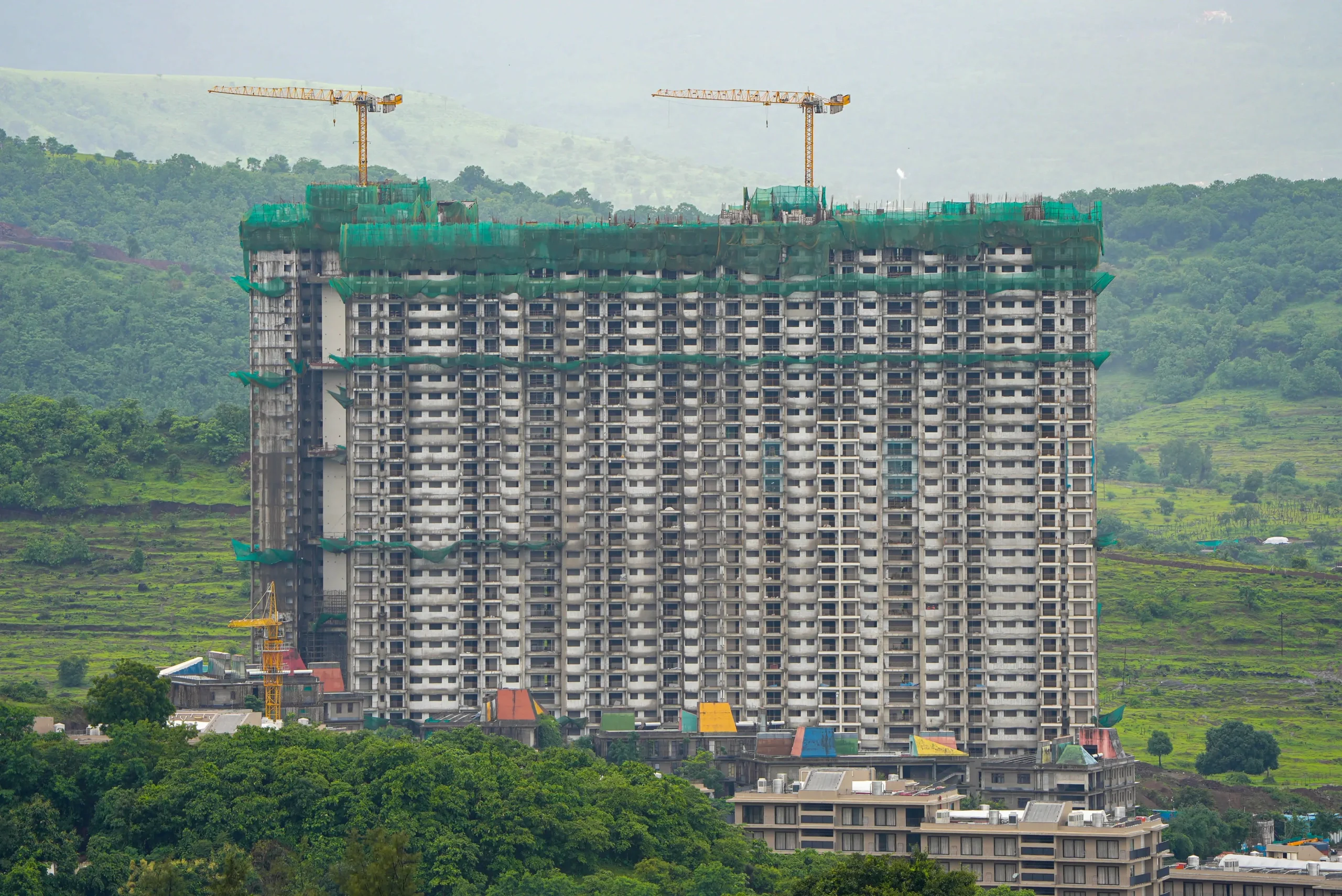
The problem is compounded when the tower is still in the early stages of construction. You are asking a buyer to commit two, three, sometimes five crore rupees to a view which is not yet in existence.
That’s a big step of faith. And faith needs something to hang on to.
This article is about how Mumbai’s sharpest developers are using precision drone cinematography — shot specifically during golden hour — to show buyers the exact view from their exact floor, before a single interior wall is plastered.
The Psychology Behind the “View Premium”
HNI buyers and NRI investors don’t decide with spreadsheets. Not at this price point.
They decide with their gut. The spreadsheet comes after — to justify what they’ve already emotionally committed to.
Visual storytelling is what triggers that gut decision. And nothing triggers it faster than seeing your future city or sea view rendered in warm, golden light at the exact altitude of your future floor.
Why golden hour specifically?
Midday light is brutal. It blows out concrete, crushes facades and creates a coastal fog that makes even the best Mumbai skylines look dull and washed out.
Golden hour – 45 to 60 minutes, just after sunrise or just before sunset – does the opposite.
It wraps every single surface in warm, directional light. It extends architectural lines. It improves the sea views. It makes city skylines look like they’ve been lifted from a developer’s brochure charging ₹40,000 per square foot.
The trust factor is real
When a developer shows a buyer the exact panoramic view from the 28th floor — not an artist’s impression, not a render guess — but an actual drone-captured image from that exact altitude — the guesswork disappears.
The abstract becomes real. The promise becomes tangible.
Technical Mechanics: How High-Rise Elevation Mapping Works
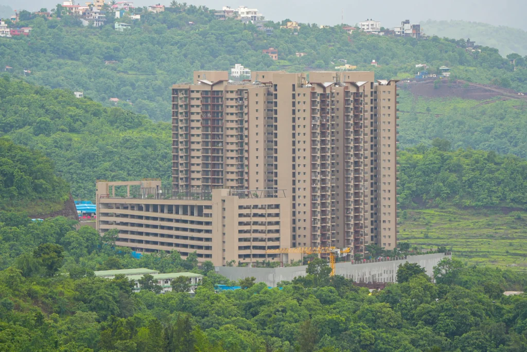
A premium hillside residential development captured from a high-altitude vantage point to emphasize architectural scale and premium natural surroundings. (Shot by Cinematic360)
This is where cinematic instinct and mechanical precision have to work together. You can’t wing this.
1. Floor-by-Floor Altitude Locking
Each floor has a corresponding height.
Using sophisticated drone telemetry, pilots calculate exact flight heights in accordance with the architectural plan of the building — normally 3 to 3.2 metres per floor, depending on the structure.
So the 15th floor could be locked at 48m. 30th floor, 96 metres. 120 metres or more at penthouse level.
Typical floor-to-altitude reference (based on ~3.2m per floor):
| Floor | Approx. Altitude |
| 10th floor | ~32 metres |
| 15th floor | ~48 metres |
| 20th floor | ~64 metres |
| 30th floor | ~96 metres |
| Penthouse (35th+) | ~112+ metres |
[CONFIRM: this table assumes ~3.2m per floor — update the figures if your standard project data differs.]
The upshot? In a Dubai sales lounge, a buyer can see – precisely – what they will see from their bedroom window in the future on a clear Mumbai evening.
Not quite. Not even close. Right.
We’ve shot for Shapoorji Pallonji on the Vanaha township in Pune, a 1000 acre integrated development. That’s not a random building shoot, that’s documenting a small city getting built from scratch. We also completed full coverage on Trans India’s project in Dharavi.
[CONFIRM BEFORE PUBLISHING: please confirm these client/project names are accurate and cleared for public mention, and add a date or link to a related case study if available.]
Every developer’s in house team shoots the building. Nobody shoots the context, and that’s the whole game. A phone clip from the podium proves nothing to a lender. What actually moves the needle is aerial footage locked to the same coordinates every month, showing the tower rising against the real skyline, next to the metro line, next to the competition. That’s the difference between a project that looks like a promise and one that looks like an asset. Internal teams film activity. We film proof.
For Vanaha, we’re talking township scale, so documentation isn’t a one time shoot, it’s a running visual record across construction phases. For Trans India Dharavi, we covered it through to completion. Standard deliverable for lender or investor use: a 60 to 90 second milestone film plus a stills annexure, built to drop straight into a pitch deck or get sent on WhatsApp. No raw dump, no fluff. Just what moves the decision. You can see how we handle ongoing documentation in our phase-by-phase site progress tracking work.
2. 360-Degree Panoramic Stitched Views
Every locked altitude is a perfect axis of rotation of the drone. These overlapping HD frames are then stitched to create a seamless interactive panorama.
These are not still images. They’re built into virtual tour apps, sales lounge touch screens or private investor microsites, so that a buyer can stand in the middle of their future view and spin a full 360 degrees. It’s as close to being on that balcony as you can get before the balcony exists.
[CONFIRM WHICH METHOD REFLECTS YOUR ACTUAL PROCESS — the previous draft contained two unfinished alternate descriptions (a tripod-mounted Sony FX3 setup and a DJI Mavic 3 Pro drone setup). Replace this note with ONE accurate description before publishing.]
[ADD EXPERT INSIGHT FROM FOUNDER/CINEMATOGRAPHER HERE — describe the actual camera or drone, settings, and shooting conditions used for panoramic stitching]
A Practical Checklist Before You Book a Golden-Hour Elevation Shoot
- The exact floor numbers or altitude ranges you want captured, not just “upper floors”
- Which direction the primary view faces (sea, skyline, greenery), so the shoot can be timed to sunrise or sunset accordingly
- Whether footage needs to integrate with 3D CGI renders later, so raw footage is shot at matching angles and heights
- At least 1-2 clear-weather backup days, since Mumbai’s coastal haze can affect a single scheduled slot
- Whether the final deliverable is for a sales lounge touchscreen, an investor pitch deck, or a paid ad campaign — each has different aspect ratio and length requirements
Compliance: What Developers Need to Know Before Flying Near High-Rises
Commercial drone operations near residential towers in Mumbai must comply with India’s Digital Sky airspace clearance system and secure zone-specific permissions before any flight. Restricted and no-fly zones near airports, defence installations, and certain government areas apply regardless of how minor the shoot seems. Every Cinematic360 shoot is fully cleared before the drone leaves the ground. For related project documentation standards, see our commercial drone photography guide for Mumbai developers.
[ADD SPECIFIC CLEARANCE PROCESS OR TYPICAL TURNAROUND TIME HERE IF YOU WANT TO SHARE IT — THIS STRENGTHENS TRUST]
Best Time of Year for Golden Hour Shoots in Mumbai
Mumbai’s monsoon season, roughly June to September, brings low visibility, haze and unpredictable wind that make golden-hour drone shoots unreliable. The post-monsoon window, October through February, typically offers the clearest skies and the most consistent golden-hour conditions for both sunrise and sunset shoots. If you’re planning a pre-launch campaign, scheduling the shoot in this window reduces the risk of costly reshoots. See our related post on seasonal real estate video marketing trends for how timing affects lead generation too.
3 Ways Drone Cinematography Accelerates Luxury Real Estate Closures
A sample golden-hour, altitude-locked drone sequence produced by Cinematic360.
1. Fast-Tracking NRI and Remote HNI Investments
Global investors are busy. A site visit in Mumbai means international flights, hotel bookings and getting someone out of their life in London or Singapore for a weekend.
Most people won’t unless they are convinced 80%.
Get them to that 80% without a single boarding pass, with a high-production golden hour drone walkthrough — the neighborhood, the transit access, the exact elevation, the view.
The physical visit becomes a formality. The decision has already been made emotionally.
A buyer based in Dubai finalized a booking after reviewing the drone footage we produced for the developer. The aerial shots showing the project’s location, nearby highways, schools, and overall neighborhood gave them the confidence to move forward without visiting the site. The developer later shared that the drone video played a key role in helping the buyer make the decision.
[CONFIRM BEFORE PUBLISHING: please confirm the developer gave permission to reference this Dubai buyer story publicly, and add a project name or date if possible so it reads as a citable case rather than an anonymous anecdote.]
2. Creating High-Impact Pre-Launch Marketing Hooks
Premium teaser campaigns have one job: create desire before there’s anything to desire. Aerial footage of a tower’s steel frame rising through the golden Mumbai mist, accompanied by music and color grading, does something a simple billboard and a QR code cannot. It builds brand authority right away. It sends a message: this developer takes presentation seriously. In luxury real estate, presentation is the product. Pre-launch social campaigns featuring golden hour drone teasers consistently attract higher quality inquiries. These buyers are already emotionally engaged before the sales team makes contact.
3. Seamless Integration with 3D Architectural Renderings
Here’s where it gets genuinely powerful. Real-world drone footage captured at exact floor altitudes serves as the background for 3D CGI renders of the finished interiors. The result is a photorealistic “future-view” walkthrough of the completed luxury apartment, showcasing its real-world surroundings at the right height and during golden hour light.
It’s not a guess. It’s not an artist’s impression. It’s the closest thing to a time machine a developer can offer a buyer.
Ground-Level Marketing vs. Golden Hour Drone Assets
| Parameter | Traditional Ground-Level Media | Golden Hour Drone Cinematography |
| View Authenticity | Low angles only, upper floors invisible | Altitude-locked, floor-specific, 100% accurate |
| Emotional Impact | Flat, clinical, buyer imagination does the work | Aspirational, warm, luxury-grade aesthetics |
| Audience Fit | Mass market | HNI and NRI buyers specifically |
| Asset Versatility | Print brochures, basic listings | Virtual tours, campaign videos, sales touchscreens, hoardings |
Conclusion: Capture the Sky, Close the Sale
In Mumbai’s luxury residential market, the developers who succeed aren’t always those with the best product on paper. They are the ones whose buyers can experience the product before it’s built.
Golden hour drone cinematography isn’t just a visual enhancement; it’s a sales tool. It reduces buyer hesitation, supports premium pricing, and transforms an under-construction promise into something a serious investor is ready to sign for.
The view is your most valuable asset. Ensure the market can truly see it. Explore our monthly content packages to see how ongoing aerial coverage fits into a full marketing plan.
Schedule a Luxury High-Rise Drone Production Consultation with Cinematic360
Frequently Asked Questions
Q1. At what altitudes are drone elevation shots taken for luxury towers?
Flights are mapped directly from the building’s architectural blueprint. Altitudes are set at precise intervals, typically between 30 metres and 120+ metres, to match the exact line of sight from each residential floor.
Q2. Why golden hour over mid-day shoots?
Mid-day light creates harsh vertical shadows, overexposes concrete surfaces, and leads to coastal haze. Golden hour provides soft, warm light that highlights textures, improves facades, and creates appealing images that justify luxury pricing.
Q3. Are there legal requirements for flying near high-rise zones in Mumbai?
Yes, and they are non-negotiable. Commercial drone operations must fully comply with Digital Sky zone approvals, secure the proper permissions for the specific area, and stay clear of any restricted or no-fly zones. Every Cinematic360 shoot is fully cleared before any flight.
Q4. How much does golden hour drone videography cost for a luxury project in Mumbai?
[ANSWER TO BE CONFIRMED WITH ACTUAL PRICING OR A RANGE — do not publish a number until confirmed; alternatively this can point readers to book a consultation for a project-specific quote]
Q5. What is the best time of year to shoot golden hour drone footage in Mumbai?
Post-monsoon months, October through February, typically offer the clearest skies and the most reliable golden-hour conditions for aerial shoots in Mumbai.
Q6. Can drone footage be combined with 3D architectural renderings?
Yes. Real footage shot at the exact floor altitude can serve as the background for a 3D CGI render of the finished interior, creating a realistic “future view” walkthrough of the completed apartment.

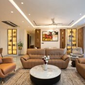
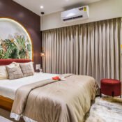
[…] Real estate photography as we know it compresses premium surfaces into a two-dimensional record of furniture placement, compresses materials and bows vertical lines. Cinematic architectural photography does something else, entirely – it creates mood, scale and emotional resonance to make a prospect feel the space before they visit it. […]